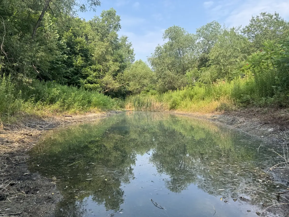
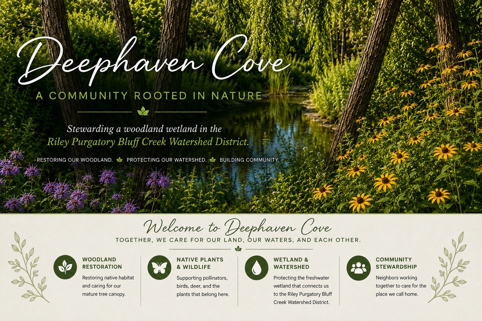
Our pond and the woodland around it.DEEPHAVEN COVEWater, woodland & a shared sense of homeView original pond artwork +
OUR POND & WATERSHED
The land beneath the neighborhood.
A pond. A woodland. A shared responsibility—and a story that began before our homes.
OUR STORY
“We are living in the latest chapter of a much older story.”
We began with landscaping. We discovered a landscape.
When restoration began at Deephaven Cove, the first changes were easy to see: flowers, revealed boulders, trees receiving attention, and a woodland that invited us to look again. Neighbors noticed birds, pollinators, and a mother deer with three fawns. Those encounters became invitations to ask a deeper question.
What is this land trying to tell us?
Historical aerial photographs let us look backward, and they shifted our attention from the buildings to the ground beneath them: the low places, the wooded edges, and the paths water could follow.
Looking from above
Aerial photographs can help us see how a place has changed. They prompt questions about earlier land uses, drainage, and the relationship between new construction and an existing landscape. They become more useful when read alongside development plans, property records, and watershed maps.
The chapter’s discovery is also a way of learning: before deciding what to change, take time to understand what is already here.
Water connects the neighborhood
A watershed is the land area that drains toward a shared outlet. Roofs, driveways, gardens, and wooded ground influence how rain and snowmelt move. Property lines organize ownership; they do not stop water.
DOCUMENTING OUR SHARED PROPERTY
Our pond. Our responsibility.
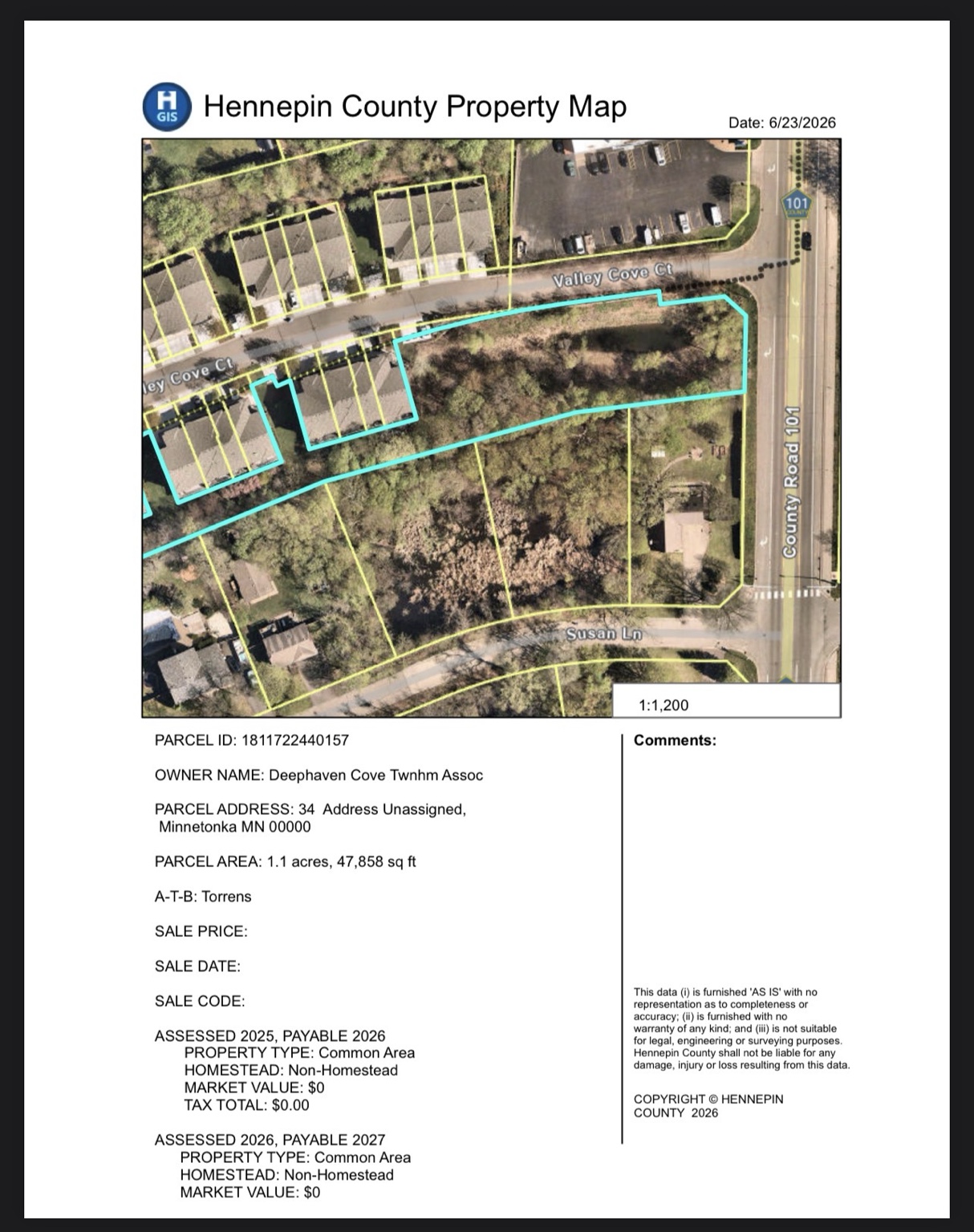
The county’s June 23, 2026 property-map printout identifies the entrance parcel as association-owned common area.
LISTED OWNERDeephaven Cove Twnhm Assoc
PARCEL AREA1.1 acres47,858 square feet
PROPERTY TYPECommon AreaParcel 1811722440157
The land we didn’t know we owned
The ownership record changed how we understood a familiar view. The pond is part of a larger parcel of shared land, with a place in neighborhood life and a history of community care.
The selected parcel encompasses the pond and adjoining land. Its area is the size of the parcel, not a measurement of the pond’s water surface. The county printout records 47,858 square feet and rounds the acreage to 1.1 acres.
The watershed district reported the same listed ownership from Hennepin County’s property map. Owners maintain private stormwater facilities, including their vegetation.
Hennepin County Property Map · June 23, 2026. The turquoise outline marks the selected parcel. Open the image to read the original owner and parcel information.
This is a county GIS property map, not a recorded plat or boundary survey. Development approvals, easements, and maintenance agreements provide further detail about specific structures and obligations.
A RECORD OF SHARED CARE
Pond care has a documented history.
The county map tells us who is listed as owning the common-area parcel. The Association’s approved budgets tell another part of the story: pond maintenance has been included as a named community expense.
These figures are allocations in the approved budgets. They do not establish how much was spent, which work was completed, or the amount needed for future care. Read together, the records help future neighbors understand that the pond belongs within the history of maintaining our shared property.
Keeping common areas functional
Rule 1.5 addresses keeping Common Elements free of obstructions. Bylaws Section 6.4 describes the Board’s authority to engage contractors, make contracts, and regulate maintenance and repair of Common Elements. These are general provisions; they do not expressly name stormwater pipes or establish ownership of a particular grate or outlet.
Understanding an individual structure still means checking the relevant plans, easements, and maintenance agreements. Preserving those records alongside a dated maintenance history helps the next group of caretakers make informed decisions.
UNDERSTANDING THE WATER
Holding water can be part of the job.
There is an essential distinction: water being present is different from water being unable to leave through a functioning outlet.
01 · WATER LEVEL
A pond need not empty.
Simply holding water can be normal. Discharge occurs when water reaches the outlet pipe’s elevation. A photograph of standing water alone does not establish a drainage failure.
02 · OUTLET CONDITION
A blockage deserves attention.
An obstructed outlet is a different question. If a clogged outlet carrying water into the city system is causing flooding, contact city public works. Reporting a concern helps the responsible people assess it.
03 · VEGETATION
Plants have a purpose.
Vegetation helps absorb pollutants. Thoughtful care considers beneficial plants, invasive growth, access to structures, and site conditions together. A tidy appearance alone does not tell the whole story.
Is it a pond, a wetland, or stormwater infrastructure?
Those descriptions can address different aspects of a place: standing water, ecological characteristics, and drainage function. It has been described as a freshwater wetland modified over time. Formal wetland boundaries, classification, and the construction sequence should be documented with the relevant maps and records.
Who built the drainage system?
Developers commonly build stormwater facilities to meet permit requirements. The original plans and approvals are the records that show who built this pond and installed its pipes.
THE 2026 RESTORATION STORY
Making room for water to move.
The restoration work brought attention to something less visible than flowers or freshly cleared woodland: the condition of the pond’s outlet. Understanding the landscape meant looking at the structures within it, as well as the vegetation around them.
A written plan for the pond
The June 2026 landscape restoration scope included retention pond cleanup, debris clearing, drainage improvements, safe access, off-site disposal, and final restoration. Recording that work alongside the woodland and entrance improvements helped connect the pond to the care of the whole property.
July 30: attention to the outlet
The July 30–31 project record describes workers addressing the outlet grate, obstructing roots, and excavation. Photographs and updates documented the grate’s removal and water flowing again. This records an observed change during the work; it is not a hydraulic assessment or a guarantee against future flooding.
From a repair to an ongoing practice
An outlet that has received attention still needs observation over time. Keeping dated photographs and maintenance records helps future caretakers understand what was done, where the structures are, and when a new concern appeared.
Neighbors also recorded encounters with deer, dragonflies, fireflies, and hummingbirds during the restoration season. These observations belong to the story of living here. They invite curiosity without substituting for ecological monitoring.
LOOKING CLOSELY AT OUR POND
Water within the woodland.
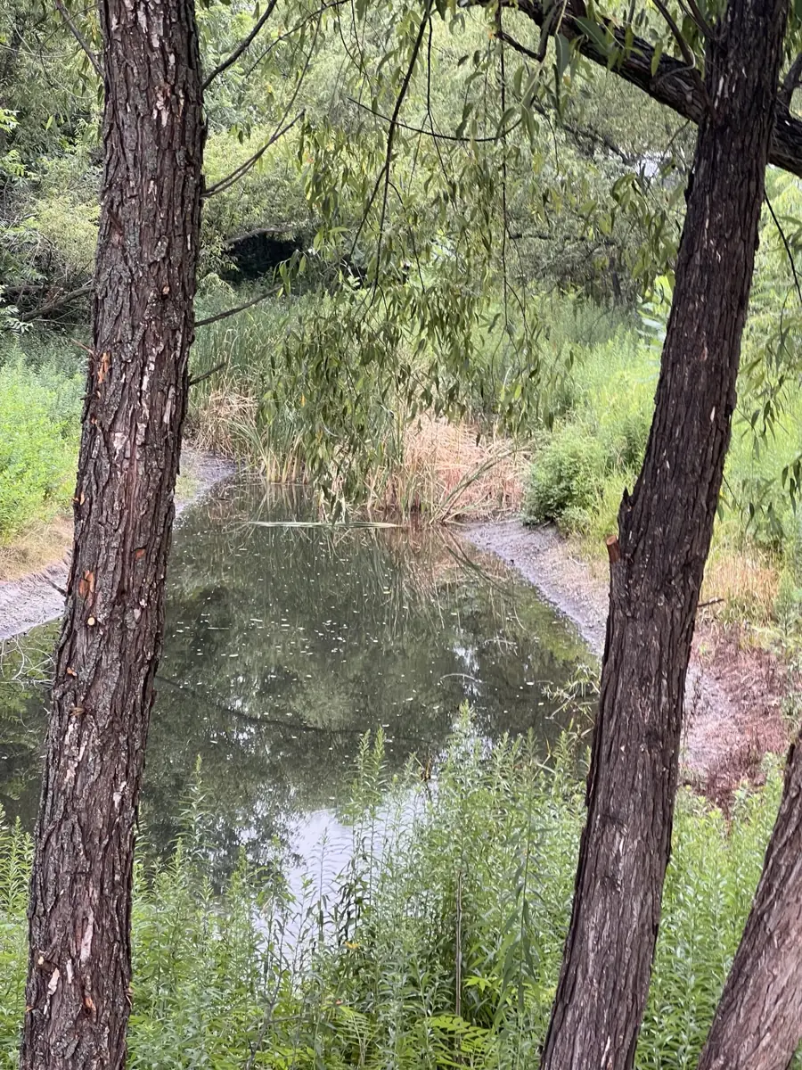
Different views of the pond, its banks, and the surrounding vegetation.
An open view across the water.The pond viewed through the trees.
TWO RESPONSIBILITIES · ONE LANDSCAPE
A living edge. A working water system.
Tending plants and soil and maintaining drainage structures are two connected parts of caring for this landscape.
Read the landscape and the records together
What is growing here? What needs protection? Where are the drainage structures? What will continuing care require? These questions belong in a practical plan for the property.
Ecological stewardship
Restoration planning includes assessing invasive growth, protecting existing native plants, selecting new plants suited to the site, and planning follow-up care. It treats restoration as a process of assessment, careful work, and observation over time.
Infrastructure stewardship
Infrastructure planning includes documenting the condition of banks, inlets, outlets, grates, and accessible drainage structures. A proposed care plan can include observations after major storms and spring snowmelt, dated photographs, and professional assessment where needed.
Notice, record, and report
From a safe location, neighbors can note a visible accumulation of debris, a damaged grate, erosion, or an unusual change in water level. Record the date and location and report the concern through association channels so it can be assessed.
Residents should stay out of pipes and confined structures and avoid deep water or unstable banks. Structural inspection, sediment removal, and repairs belong with qualified professionals and the appropriate approvals.
A care plan should identify the structures, responsible parties, inspection needs, and follow-up records for this particular site. The newsletter’s illustration is an educational concept, not a verified map of the neighborhood’s pipe connections.
Our opportunity is to connect the history of this place with a practical plan for its care. That means documenting the drainage system, evaluating maintenance needs, and considering the woodland, water, and habitat together.
Neighbors can help by noticing changes, recording a date and location, and sharing a clear description or photograph. Coordinate common-area work through association processes and appropriate technical guidance.